2007 Summer Family Vacation

Our 2007 summer family vacation was to New Braunfels, San Antonio, and Houston, TX. Here are the highlights.

I-35

I-35 northbound was amazingly backlogged between Austin and Dallas. We found three places where wrecks shut down one or both lanes, resulting in miles of backups. I had never seen anything like that before. Fortunately, we were headed southbound.

This was a typical backup:

Those vehicles in the northbound lanes were almost parked.

Rumors of heavy truck traffic were exaggerated. Sure, there were plenty of trucks, but cars hugely outnumbered trucks. If this trip showed typical conditions, the problem with I-35 is just too much overall traffic.

Southbound wasn’t too bad, although we could rarely sustain speeds over 75 mph.

County Line Barbecue

We went to County Line Barbecue on Bee Cave Road in Austin the first night. Great place, great view. Food is good, albeit a little pricey. We enjoyed it so much we also ate at the San Antonio River Walk location a few nights later. We would have purchased dessert if they had any cobbler besides apple cobbler!

1909 Gruene Road Bridge

By total coincidence, we crossed over this historic bridge over the Guadalupe River the very day TxDOT finally decided to replace it.

There’s nothing terribly exciting about it. The day we were there, water was coming down both slopes to the bridge. I didn’t understand why unless there are natural springs emptying out on the road or water was being pumped out and let back down?

Gristmill Restaurant, Gruene, TX

The Gristmill Restaurant in Gruene is all outdoors and a neat stop. Good food, nice change of pace. The adjacent Gruene community is a tourist trap, though.

Schlitterbahn

Schlitterbahn was about as I remembered it from church youth group trips, albeit with a third park: Blastenhoff. The only disappointment was that our 3½ year old Alec could do almost no rides due to height and swimmer capability restrictions, so that $100 of entrance fees didn’t go very far. It would have made more sense with a large group, where some could watch the kids while others have fun.

My only real complaint about Schlitterbahn is the lengthy expanses of concrete. They tear up bare feet. The only real alternative are sandals or water socks, either of which rub feet raw after enough hours of water fun.

Natural Bridge Caverns

Natural Bridge Caverns is a privately-owned cave park. It’s named after this natural bridge that’s over the main cave entrance:

The caverns were phenomenal. We did both the Jaremy Room and the normal cavern tour.

The Jaremy Room was full of spectacular soda straw formations:

The North Cavern had equally spectacular sights. Recent heavy rains caused the Edwards Aquifer to rise unusually high, flooding low parts of the cavern. This is a submerged bench where you could have gone down many more feet to see a special room:

We saw a few bats:

The last part of the North Cavern tour was the most spectacular. Below are four long exposure shots I took of its largest room:

The tour guide said you could fit a whole football field in this room. I believe it.

To be clear, even though it’s privately owned, Natural Bridge Caverns is not a tourist trap. It’s well worth the expense.

San Antonio River Walk

The night after the cave tour, and two additional nights later on, we did the San Antonio River Walk.

I think San Antonio did a great job at capitalizing on this natural resource. It’s a nice, pleasant walk, and it gives easy access from many hotels to good local attractions.

This is a scene looking north from a Häagen-Daaz that stunk of an open sewer:

Here’s the River Walk closer to our hotel, which is south of the main part. Looking south from Woodward St.:

Looking north:

The waterfall/lock/dam, just about 1000 feet north of the hotel:

Walk a little further north, cross the street, descend again, and look under a bridge, and you see this:

Every day, they parked this city truck with the rear wheels in the water! They better hope the ramp isn’t slick!

Walk a little further north, and you see the corner to turn to get to the main part:

Take a corner to the right, and the lush part begins:

Towards the southeast corner of the Walk is a theater:

The seats, on the other bank, are grass:

This is one of several rosary bridges visible from the River Walk:

Casa Rio Restaurant

Casa Rio has an entrance from street level, and it has a lot of tables on the River Walk:

This is where we ate our first night. I heartily recommend this place. The prices were surprisingly inexpensive, the service and food were great, and the river view is nice.

Rio Rio Restaurant

We ate there our last night, and regretted it. Rio Rio sucks.

Don’t bother. Crap service, food wasn’t any better than the much less expensive Casa Rio Restaurant. It took so long just to get our food ordered that we almost just got up and left like at least two other tables that night.

Inn on the Riverwalk

Fair value. See my detail post on this place.

Sea World

We really enjoyed Sea World. Alec’s inability to do most rides didn’t detract from the overall experience. There was plenty to do despite that. It was also nice that all restaurants didn’t use any trans fat-laden oils.

Obligatory picture of Shamu (mmm, tasty fish):

We didn’t sit close enough to be splashed. Alec’s cousin got freaked out by being splashed when he was 3, so we didn’t want to risk it.

A tasty fish breaching the water at a different show:

Alec feeding a tasty fish to a tasty dolphin:

($5 for 4 little fishies!)

Halfway through the day, we got Alec measured to see which rides he can do:

Alec loved the Shamu roller coaster:

That and a teacup/ferris wheel ride were all he could do. Mommy and Daddy had enough after 8 hours at the park, so Alec “only” got to ride Shamu about 7 times.

Looking back, we would have done a few things differently:

  • Stayed at a nearby hotel at least the night before and the night after. Sea World takes all day and then some. There’s no point in staying downtown if you’re doing Sea World one day.
  • Take a nap during the middle of the day. Alec still needs a roughly 2 hour nap. He skipped his nap that day. While he was tolerable, it sure would have been nicer if we could have left during the middle of the day for a nap.
  • Get the bonus 2 day pass. We purchased tickets in advance, and we thought we saw an offer for 2 days for the price of 1 day. Had we stayed at a nearby hotel, we should have pursued this. We didn’t even get to touch the water park. We probably would have done that instead of Schlitterbahn had we realized how little we could do there.

We did Sea World the day after Natural Bridge Caverns. The cavern had a ton of steps, so Alec’s legs were sore when we started Sea World. Being a very mean Daddy, I made Alec walk anyway because I knew that they wouldn’t hurt once he really started walking. (I was right.) He retorted that his legs “are gonna break off.”

San Antonio Zoo

The San Antonio Zoo was acceptable. It doesn’t deserve acclaim, and it wasn’t particularly unique.

Alec enjoyed brushing a goat in the petting zoo section:

We enjoyed a train ride through Brackenridge Park afterwards.

Our enjoyment of the zoo and the park were tempered by sparse water fountains and oppressive heat.

The Alamo

I couldn’t find the basement!

Alec in front of the Alamo:

The Alamo was originally the first of several missions that are in…

San Antonio Missions National Historic Park

…the San Antonio Missions National Historic Park. This “park” is really a set of 4 defunct missions on the south side of town. They are interesting historical artifacts and continue to have functioning Catholic parishes. They suggest what the Alamo compound was like in its mission days.

These missions weren’t intended to exist as missions indefinitely. The plan was apparently that once the population was sufficiently Christianized, the mission reverted to civil authority.

The missions seem to be in declining states of repair or prominence the further south they are from downtown.

Texas Transportation Museum

San Antonio’s Texas Transportation Museum is neat but run down. It’s a volunteer operation.

The staff were unexcited to have visitors, treating us as if opening up to the public is something they had to do, not something they wanted to do.

Central Texas Museum of Automotive History

Awesome. See my detail post.

Houston Arboretum and Nature Center

The Houston Arboretum and Nature Center was a complete waste of time unless you like walking through mosquito-infested undisturbed forest filled with non-notable flora. It was free, and I still felt ripped off.

Museum of Printing History

Houston’s Museum of Printing History was nice. Give yourself an hour just to read the stuff, longer if you want to take part in the exhibits.

Roadtrip tire experience from heck

Right now, we are returning from a trip to Houston. That’s right, we are returning at this moment. The internets and Googles on the cell phone iz awesome, and I’m not driving. :-)

Yesterday afternoon, I found a deflated front tire on our Maxima. It was fine the night before. This is a problem because I had to get it fixed on New Year’s Day and, if unrepairable, I have to get a hard-to-find tire size. (Check any major tire chain for tires for a 2002 Nissan Maxima SE–most have to special order the tires!)

Wal Mart was the only nearby, open-on-New-Year’s-Day tire place. I made a trip to the tire department and got it fixed. Mounted the tire, and it lost 3 PSI over the next hour. Great, back to Wal Mart. On the second trip, we found a nail in the tire’s shoulder, which is between the sidewall and the main treads. The Wal Mart techs couldn’t fix it per company policy. Discount Tire and others say you aren’t supposed to repair nails outside the main tread area. This makes some sense; radial tires aren’t rigid like the old biased tires. They continuously flex up and down with each wheel revolution. A patch in this part of the tire could easily work itself loose.

Can’t fix it, and I am not going to drive back with this tire. The nail could work itself loose in transit. If it does, all I have is that temporary spare, leaving me little option but to depend on the generosity of Bubba in a “middle of nowhere” town, and it’s unlikely Bubba would be able to get me another 225/50R17 tire in short order.

Wal Mart didn’t have my size tire in stock. They would have to special order, and that would take 3-4 days. So after calling several places, many of which weren’t even open, I lucked out with a Sears only 9 miles from the Wal Mart that had a suitable tire in stock. $157 and 1.5 hours later and we are on the road.

By the time we finally left Houston, we could have been home for 30 minutes.

We ended up with a decent Falken tire. It has more tread than the other front tire, so the front alignment is slightly off.

Pennsylvania and New York City trip

This June I took a trip to Gettysburg College in Gettysburg, Pennsylvania for a business trip. After the conference, I joined my wife in New York City.

It started out a decent morning with almost clear skies.

I got a great picture of my neighborhood from the plane:

The flight was uneventful. I was able to pick out El Dorado, Arkansas because I remember at US 167 near it on a satellite image a few months back. I also think we passed over Chattanooga, TN. I figured that out because of Chattanooga’s large water feature on the northeast side of the city.

After landing at Baltimore-Washington Airport and ducking around a ceremony to dedicate the airport to Supreme Court justice, I was picked up by a Nova-owning friend in his ’63 Nova convertible. He gave me a great walking tour of Ellicott City, Maryland. Next, we went to his house in Catonsville, which is unincorporated Baltimore County. Surprisingly, Baltimore County, which includes over 700,000 residents but not the city of Baltimore, has no incorporated cities! Ellicott City is also unincorporated even though it is the county seat of Howard County, which also has no incorporated cities! (There’s something weird about Maryland.)

The most amazing thing I saw in Maryland was the Nova buddy’s Japanese maple tree:

For someone who is used to diminutive shade trees, this is an amazing specimen. It’s in full sunlight, and it’s huge! When this neighborhood was built in the ’60s, some gypsies came through and sold these maples. Many houses still have these trees, and they are in various forms. This specimen was one of the most stunning ones on the street.

It was nice seeing more of this area of the county.

That evening, the Nova buddy took me to Gettysburg for my conference, the Gettysburg College Portal 2006 conference.

Gettysburg College is a nice campus. SMU’s landscaping blows it away, but it’s still nice to see northern vegetation.

I thought this tree was interesting:

The college had several like this. I believe it was some kind of weeping form pear tree, but I am not sure.

I was also intrigued by this:

At that intersection, you have to stop unless you’re making a right turn. The road to the right T-ed into the road this stop sign regulates.

This could cause a problem if an oncoming vehicle prepares to make a left turn assuming you will first stop at the stop sign. It is still necessary to yield to vehicles in any intersection, but it seems this could cause confusion. A guy who lives in the same state just told me this is common at Pennsylvania T-intersections.

After the conference, I went to the Union Station in Harrisburg, Pennsylvania to catch a train to NYC. I saw the capitol building from a couple of blocks away. I wish I had time to check it out more closely. It had an interesting green dome.

Here is the front of the station:

While functional, the station wasn’t in good repair. You could tell 2006 is not the heyday of train travel. As an example, behind where I took the above picture was a bus depot. Some of the glass roof was replaced with rotting plywood:

Texas isn’t a “rich” state, but I don’t usually see this kind of dilapidation in Texas.

This is where I waited for my train:
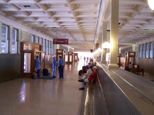
This isn’t the main hall of the station. In fact, this station didn’t really have much of a main hall. This is like an enclosed bridge over the rail lines. When your train is ready to load, you go down the stairs. If you look out the windows, you look into a large shed-like structure:

This is looking west, which is not the direction I traveled:
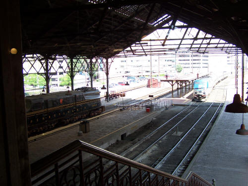
The train on the left is some old, apparently retired engine. I couldn’t figure out what it is.

Harrisburg is the end of the line for the train I traveled, but other Amtrak trains pass through Harrisburg that came through Chicago, Cleveland, and Pittsburg.

Looking east:

That’s my train on the left.

The route I took is called the Keystone Service. It runs a few times a day between Harrisburg and Penn Station in NYC.

This is the diesel engine that took the train to Philadelphia:
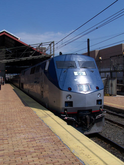
Here is what my seat looked like:

Plenty of legroom, plenty of width. The tray was a little too high for typing comfort. It had plenty of electrical outlets! I was able to charge my phone and laptop on the trip!

Few people were on the segment between Harrisburg and Philadelphia. At one point, a foul mouthed girl sat behind me and loudly told her friend on a cell phone how many ways she got “fucked up” the prior night with booze and drugs. I was glad that skank got off at Philadelphia.

Just a little west of Harrisburg, I saw these on the south side of the track:

Looks like we have a nuclear power plant!

(Oh my gosh, I am just now finding out that this the Three Mile Island from the infamous 1979 nuclear accident! The two stacks at the left are part of the reactor that has been offline since the disaster.)

The scenery rapidly whizzes by:
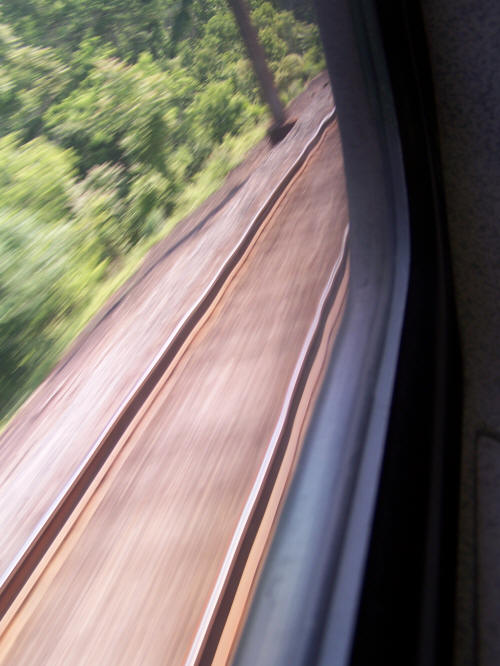
At this point, the track is old with wooden ties:
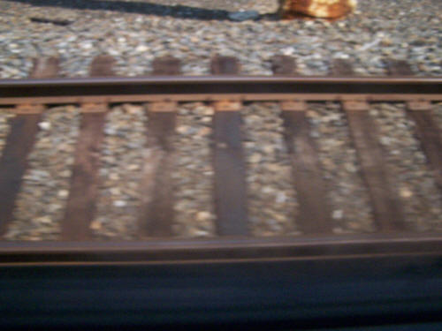
This is a 1/1000 shot using ISO 400 mode. You can tell we’re buzzing along pretty quickly. I think we were doing 80-90 mph a lot of the way.

Decrepit train station that’s still in use:

I think the tall structure is some kind of cargo elevator. It’s boarded up. Look to the left a bit, and you see the building and part of the platform:

The train stops at every station on the way to Philadelphia, so that’s why I got a good still shot.

The ride was, for a lack of a better word, “wobbly” on this old wood track. Amtrak is slowly upgrading the track between Philadelphia and Harrisburg to accommodate faster, electric trains. Once we hit the newer track with the concrete ties, the ride was a ton smoother:
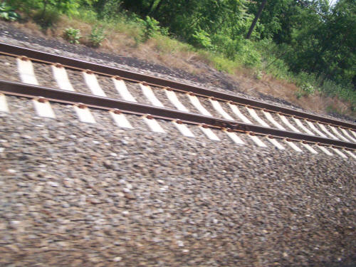
1/800 and ISO 400, so we are again moving at a rapid clip.

During the train trip, I was able to plot out my location on my PDA using Jason Fuller’s Virtual Earth and my wireless internet. I had at least 1X data service most the way, but I had EVDO in Philadelphia and even in an occasional small city on the way.

I somehow failed to take any more pictures the rest of this day.

The train stopped at the 30th Street Station on the west side of downtown Philadelphia. I never went into the station because the train was only stopping long enough to change engines. You see, an electric locomotive is hauls the train from Philadelphia to New York. So the diesel locomotive was disconnected from the “front”, and an electric locomotive was connected to the “rear”. I like riding near the locomotive, so I switched to the car on the opposite side of the train.

Many people entered the train in Philadelphia, making the ride between Philadelphia and NYC almost full. I caught up on some sleep on this segment. I recall that the New Jersey segment had very few truly rural areas.

Occasionally an Acela Express train whizzed by. They appear with a bang and hastily slither past. I believe the marketing that these things run 150 mph on open stretches.

One thing that was interesting is you could often see an abandoned track on the west side of the rail corridor, in addition to 4 to 6 “through” tracks. Often this abandoned track was heavily overgrown and had separate, older bridges.

Over an hour later, the conductor announced we are at the Newark, NJ airport. I casually looked out both windows and was surprised to see the New York City skyline out the east side.

About 15 minutes later, after snaking through some marshland and crossing under the Hudson River in a tunnel, I arrived at Penn Station in NYC.

Getting out at Penn Station, my reaction was culture shock. People everywhere, rushing around! This is disorienting to a Dallasite, where there is usually a comfortable space between you and the next person. There are few times in my life where I pause and let my jaw drop to the floor. This was one of them.

I immediately caught a subway (more people) to one stop north of Penn Station and got out (more people) and walked half a block (more people) to my brother’s apartment. He lives on the 5th floor of a walk up apartment, meaning there is no elevator. The apartment evoked many stereotypes of New York apartments: interior, narrow staircase; you can hear and smell things going on in the other apartments as you walk through it; the apartments are small; and so on. This place is a block and a half from Times Square (more people), so with the windows open, you hear a constant NYC din. Now, all things considered, my brother’s place was actually reasonably nice. We slept fine, and the neighbors didn’t bother us at all. We weren’t there very much for the whole trip, anyway.

As soon as I dropped my stuff off, I had to leave again to meet my wife at LaGuardia Airport. So that meant another subway ride up to 110th St. and then a 1¼ hour ride on the M60 bus.

This bus went most of its way across 125th St. in Harlem. Again, more culture shock. It is said that Harlem is revitalizing. If this is the result of revitalization, I sure don’t want to know what it was like 10 years ago. Harlem makes the bad parts of Dallas look like the suburbs.

Traffic was incredibly thick, and the sidewalks were crowded.

After Harlem, the bus went over the Triborough Bridge. This was a neat suspension bridge. An interesting sign advised that photography is prohibited and “strictly enforced.” Whatever. Apparently, they fear terrorist plotting.

Not long thereafter, I picked up Jennifer at LaGuardia. We took a different bus/subway combo to get back to the apartment. That was the only above-ground subway I rode the entire trip.

The rest of the evening wasn’t very notable.

The next day, we did a major walking tour. We started early at Union Square and walked a winding path all the way up to the southeast corner of Central Park before quitting.

I thought the Flatiron Building was neat. You can’t make it out in this shot, but the building has window A/C units!
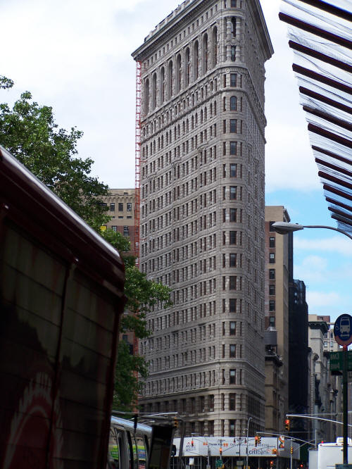
We zig-zagged for a while and saw some neat stuff. Eventually, we came cross this:

The museum of sex. The sign in the window was funny:

We stopped by the flagship Macy’s. I was surprised to see that even though the building has plenty of windows, almost all of them were blocked off.

We had lunch at Grand Central Station and walked by several significant buildings, including the Chrysler Building and the Empire State Building. Before lunch, we stopped by the Morgan Library, who market themselves with the snooty name of “The Morgan.” Being inside that museum was funny. Jennifer and I, in our tourist garb, were literally surrounded by east coast, intellectual-looking, moneyed types. The stereotypical liberal, “dressed in suits without a tie on a summer day,” expensive jewelry-wearing crowd. The stuff in the museum was pretty good: lots of old, important books. My favorite piece was an anti-Catholic 16th (17th?) century vase by a Protestant which depicted two large wolf-like animals simultaneously vomiting and defecating. I forget the actual message, but it was criticizing something about the Catholic church.

Right before we hit the United Nations headquarters, I saw this:

I had no idea that The Onion is an actual circulating newspaper! All this time, I thought it was just an online oddity.

Next was the United Nations Headquarters. Here’s the Security Council chambers:
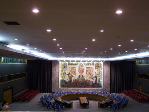
I got such a nice shot because I didn’t use the flash.

The tour guide asked us for examples of what the Security Council does. I so badly wanted to say, “it helps Iran get nuclear weapons.” I bit my tongue, HARD, to hold back.

The signs gave me several giggles:

Notice how everything is in English and French? Know why? French used to be the language of international communication. English has taken over now.

Here’s one of the few worthwhile pieces of art in the UN. It was donated by the United States:

Here’s the General Assembly chambers:
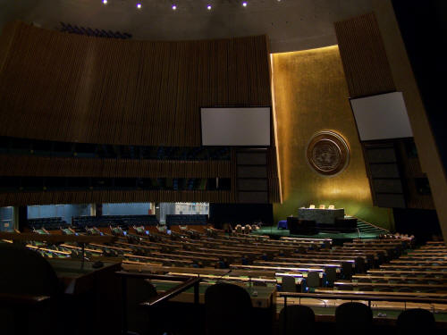
This is where they perform important tasks like repealing our right to bear arms or setting up international court systems to punish Americans.

Here’s a close up of that seal in the back of the room:
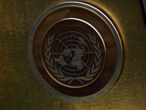
The tour guide asked why the map shows the world from the perspective of the north pole. Just for shock value, I wanted to say, “because the vast majority of political, economic, and humanitarian activity happens in the northern hemisphere.” But I didn’t. The explanation is something silly like this projection allows all countries to appear equal or something. Sure, Australia seems like an equal when it’s all squished like a pancake.

More French, and a sign with the marketing panache of the USSR.

While UN is busy banning guns, do they realize what their own security guards are wearing?
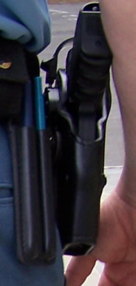
Yup, big, nasty guns.

By the way, it is often said that a prominent apartment building near the UN’s southwest corner has no windows on its west side because the UN property used to be a slimy meatpacking district. Turns out that is untrue:

Probably another lie concocted by those UN hippies.

From there we did more sightseeing. The Citigroup Center is fascinating.

This 59 story building starts 114 feet above street level. It’s supported by five massive piers. The reason for this is because a church already occupied one corner of the block and didn’t want to move. The church would only allow the tower to be built over it.

The rest of the day was spent looking at more touristy stuff.

The next day, we attended the Riverside Church‘s 10:45 AM Sunday service. We went there in part because our home church’s youth choir happened to be in NYC the same time and was performing at that church. This was an amazing building. It wasn’t of the same prestige of Washington National Cathedral, but it was still impressive nevertheless.

After the service, we visited the adjacent Grant’s Tomb.

It seemed rather strange that inside this tomb is a gift shop!
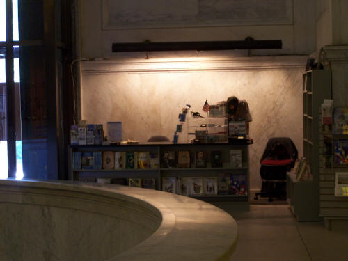
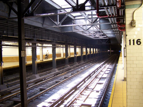
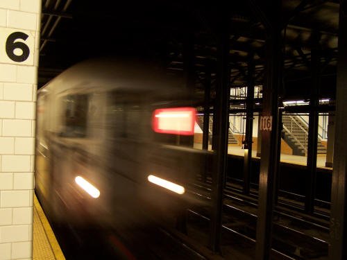
Here’s a picture of the 116th St. subway station near the church. This station actually has sunlight, so it is rather unusual.
Here’s our train rushing at us:
After lunch and changing clothes, we went to the TKTS booth to pick up tickets for a musical. A few bums are out front distributing fliers showing the remaining musicals for the day. Even though they are required to give these out for free, these bums demand a “donation” (more crack money) before they give you anything. I have no idea why TKTS allows hardcore bums to hand out this stuff.

Having several hours to burn, we went to my brother’s (now former) workplace (a retail establishment) at 86th and Lexington. From there, we took a bus south to Bloomingdale’s to check out that place. Then we stumbled across the aftermath of the Puerto Rican Day Parade:

That truck in the background is a street sweeper. Apparently these things are huge vacuum cleaners. They pick up a lot of stuff on each pass.

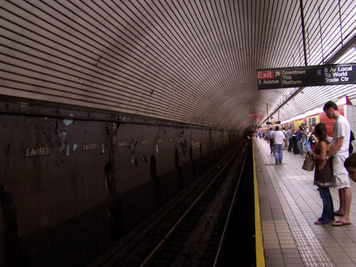
We made it through throngs of departing Puerto Ricans to the nearest subway station. Here’s the 5th Av./53rd St. station:
That evening, we saw Avenue Q, an adult themed musical featuring a cast of humans and puppets, many of which spoofed Jim Henson’s Muppets. We really enjoyed it.

The next day we started out at Central Park. After about 30 minutes of touring, we had seen enough (we live next to Dallas’s flagship park, so parks aren’t a novel experience for us). We walked over to the upper west side and caught a bus back down to the vicinity of my brother’s apartment.

That afternoon, we attended a taping of the David Letterman show.

Here’s how it works.

Several weeks before you visit NYC, you visit the show’s web site and enter their ticket lottery. Before the taping, if you are selected, an employee calls and asks a trivia question. (They asked Jennifer what line of business Rupert is in.) If you get past that, your name goes on their list.

On the day of the taping, they let people in the building from 2:00 PM – 3:00 PM for a pre-screening. We arrived at 1:45 PM. When you get inside, you are queued into a few lines. At the top of the line, you get briefly interviewed by an employee. This employee hands you a ticket, and it has one of three things: a signature, a number, or some other unknown marking.

If your ticket has a signature, that means you are stuck in the balcony.

If your ticket has a number, you may sit on the lower level.

If your ticket has some other, unknown-to-me marking, you sit in bottom center.

We got numbers:

They set us free until about 3:30. When we came back, we queued up again, but this time we lined up according to our number. At 3:30, the entire numbered throng re-queued in the theater’s atrium. Due to some delays, they had us in there for quite a while.

Finally, they let us in the theater. Jennifer and I ended up on the furthest, rightmost two seats (from the stage’s perspective), about 7 rows back from the front. This was right in front of the band. We got a really good view of the entire stage.

The show’s staff ran the place with a casual precision. That is, they were constantly joking and cutting up, but they knew where fun ended and business begun. I could tell that the show is well rehearsed. This show featured Paris Hilton and Will Shortz.

Paris was just dumb. She couldn’t interact; all she could do is respond to Dave’s questions. Will Shortz, the guy whose Puzzlemaster feature is on NPR’s Weekend Edition Sunday, was interesting but really dry. What else can you expect from a guy who creates crossword puzzles for a living?

Unfortunately, the show wasn’t that interesting.

Before the show, we walked by the Hello Deli:

This is Rupert’s business. Notice any writing behind the green sign? This guy is too cheap to properly cover up the old shop’s sign:

The Hello Deli’s prices were surprisingly reasonable–by New York standards.

This is a throng awaiting Paris’s arrival to the David Letterman show:

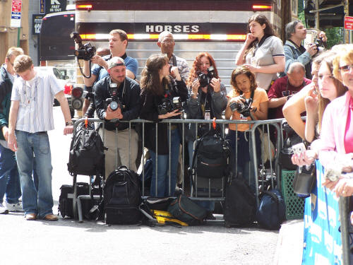
Several paparazzi were there, too:
After the Letterman taping, we stopped by a nearby Food Emporium grocery store. In some ways, it was surprisingly similar to an everyday grocery store. Everything in the store is closely spaced, and not much of each kind of produce can be on the shelves. You could barely fit a shopping cart in the aisles. Stocking the shelves has to be a constant operation. A disproportionately large percentage of the store was dedicated to ready to eat foods. I guess New Yorkers don’t have time to cook? Prices were amazingly high, but I guess that’s to be expected in NYC?

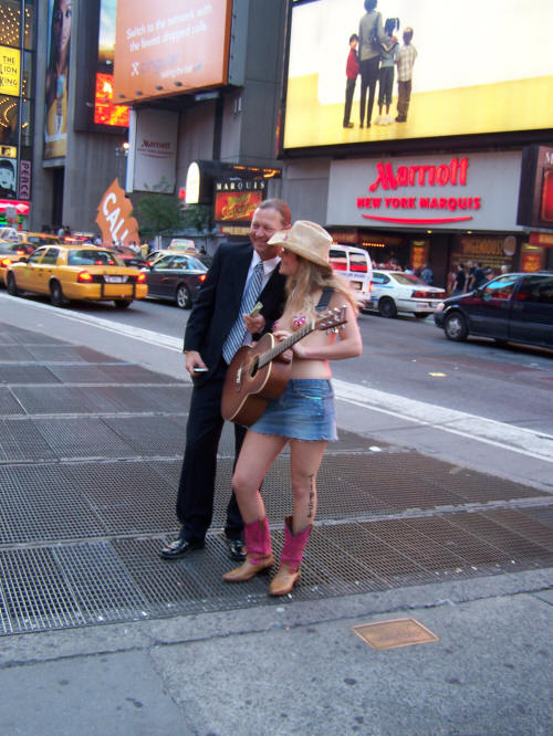
That evening, we wandered around Times Square some more. We encountered The Naked Cowgirl, who was two pasties away from a public indecency citation.
That evening, we ate at Virgil’s BBQ off of Times Square. That was good food. We ate so much that I didn’t feel good the rest of the evening.

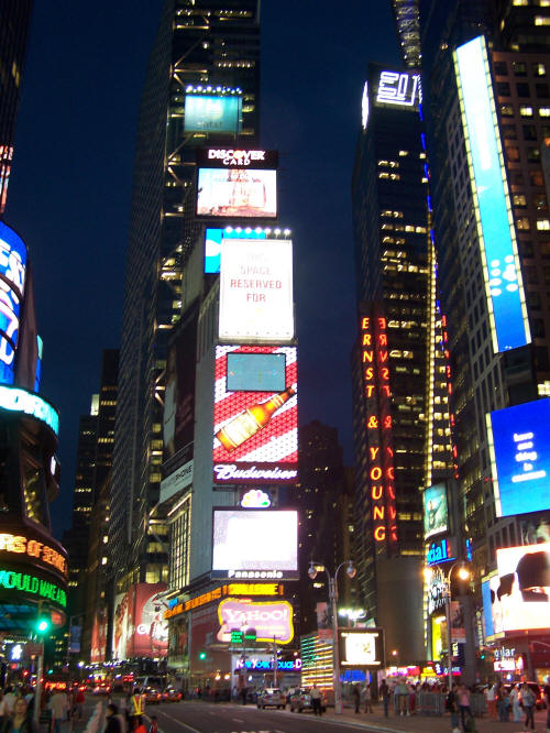
Obligatory pictures of Times Square:
We met my brother at his store because we wanted to take him for dessert that night. It turned out that his perennially understaffed store had a lot of cleanup to do, so that gave us time to talk to Gracie Mansion and back. It was a neat walk, especially at 10:00 PM at night. When my brother was finally done (11:30 PM), we waited for a bus at a nearby bus stop. Within a few minutes, a glass beer bottle shattered in front of me. Some invisible idiot threw the bottle from a second story bar, and this bottle barely missed my head.

We finally hopped a bus and headed back to the Upper West Side to Cafe Lalo, the cafe featured in a scene of the movie You’ve Got Mail. This place is well aware of its fame. Why else would I have to pay $6.50 for a slice of cake?

Here’s what subway stations look like at 1:30 AM:

We stumbled into the apartment around 2:00 AM and immediately crashed.

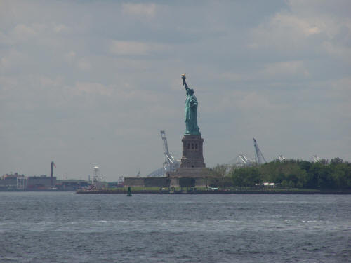
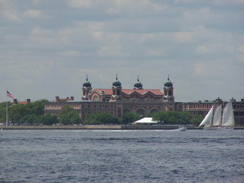
The next day we toured lower Manhattan. We started out at 12:30 PM at Battery Park. By that time, all tickets to the Statute of Liberty museum were sold out. You could still hop a ferry to the island, but that’s it. That fact, plus the discovery that Ellis Island charges $5 for each attempt to look up names, changed our minds. We got some good shots from the shore and went on.

Statue of Liberty:
Ellis Island:
On the other end of Battery Park is The Sphere, a bronze piece of art that was saved from the WTC rubble:

I think a more permanent enclosure or 9-11 memorial is being built behind it.

The streets in lower Manhattan are crazy: they are narrow and go every which way

Here is the NYSE:

The WTC site:

Yet another bum was nearby, yelling out conspiracy theories and handing out leaflets.

City Hall was surprisingly fortified.

Here is Chinatown:

Very crowded with shops selling touristy crap. Beware of the t-shirt shops: those emblems will wash off in no time.

After Chinatown, we took a bus down to the free Staten Island Ferry. This gave a lot of good views.

Another angle of the Statue of Liberty:

Lots of sailboats:

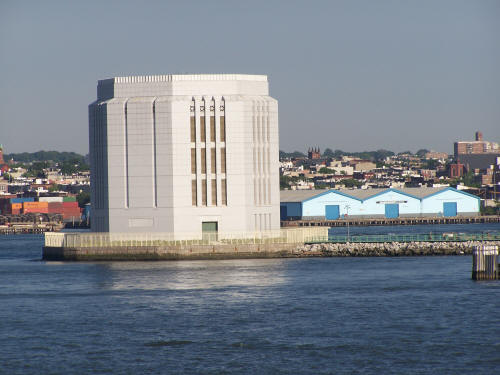
I have no idea what this is.
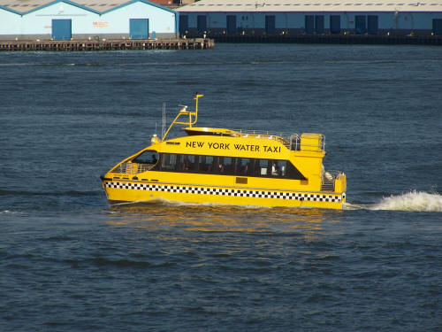
I’ve heard of these water taxis but never seen one before:
Being exhausted, we didn’t do much of anything else that evening.

The next day we took public transit to LaGuardia and flew home. We were exhausted.

While this was a fun and interesting trip, New York City is a “nice place to visit, never want to live there” place.

Thanksgiving Trip

(The moghst exciting “roadgeeky” thing about this article is the Regency Bridge. Scroll down 2/3 of the way to see the photos of the only suspension bridge open to vehicular traffic in Texas.)

I visited my family in San Angelo, TX for Thanksgiving. (Nobody is from there, but my grandparents and an uncle’s family happen to live there right now.)

On the way there, I took almost all back roads. The “preferred” route is to take I-20 west to Abilene, US 83 south to Ballinger, then US 67 to San Angelo. I’ve done that route several times, so it has lost its excitement.

An alternate route is to take US 67 all the way from Dallas to San Angelo. I did that in April. It was different, but it wasn’t very exciting.

This time I did most miles on Texas Farm to Market roads, some on Texas State Highways, and a little Interstate driving.

I couldn’t have asked for better weather:

The whole day was mostly sunny and in the 70s.

I started out heading south on Buckner Blvd. (a.k.a. Loop 12). I took Buckner all the way through Buckner and Lake June, a notoriously unsafe part of Dallas.

Here’s where Buckner crosses under Military Pkwy. Notice how Dallas used black-trimmed traffic signals? My neighborhood is fighting to get touches like this integrated into a upcoming rework of the Buckner Rd./Garland Rd. intersection.

Buckner and Lake June:

I continued south to where Buckner turns into Murdock Rd. I was surprised to see how rural that area quickly became. It would be a nice area if only it wasn’t so close to a high-crime spot. Where Murdock weaves left and becomes Dowdy Ferry Rd., I accidentally continued straight. I drove past Lincoln Memorial Park Cemetery, which was pretty attractive. However, I could tell that Rylie Rd. was a major dump site. Loads of illegal trash was all over the place. There’s no telling what area residents are encountering.

I got back on to Dowdy Ferry Rd., continued south to I-20, then headed west on I-20. Closer to I-20’s intersection with I-45 is the start of the experimental “no trucks in left lane” project:

I-10 west of downtown Houston is where this experiment first took place. Crashes decreased by 68%, so Texas expanded the program. It’s being tried out on I-20 south of Dallas and I-30 east of Ft. Worth.

I continued on I-20 to I-35E, then headed south on I-35E.

I-35E is just a typical interstate. Much of the construction south of I-20 was completed. However, construction picked up a few miles south of Desoto, squeezing traffic down to one lane in several areas. I was able to zip around most of the backups on the access road.

This is a typical I-35E scene just north of Waxahachie:

Now the fun begins. In Waxahachie, I exited on FM 66. Bye bye interstates! The rest of the trip was on Farm to Market and Texas State Routes. This was a typical scene for the next many miles:

I thought the following construction zone was interesting. Instead of using flaggers to regulate traffic flow on a 1 lane part, the construction zone utilized a set of portable traffic signals:

At various points on FM 66, I saw new homes like this:

I had no idea why someone would want to live in the middle of nowhere, surrounded by nothing but flat, boring cropland. Later, someone explained that it’s probably because of proximity to Dallas. I still don’t get it. Huge commutes just for this?

After Maypearl, I encountered another one lane construction zone regulated by a portable signal:

I wasn’t clear what the holdup was:

Here are more of those goofy, “middle of nowhere” houses:

Boooooooring.

On a short jaunt before I-35W, FM 66 has what appears to be the original cement surface:

That was neat. The rest of the road was traditional asphalt.

Finally crossing I-35W

(Stupid camera focused on my radar detector or windshield, not the road.)

I drove through Itasca and got on FM 934. Just west of TX 171 in a community called Osceola, I saw this bizarre scene:

You’re seeing boys and girls playing volleyball. The girls are all in long skirts and have long hair. I never imagined you can find sects this close to DFW. This particular group calls itself the Osceola Christian Fellowship.

FM 934 T-ed into FM 933, I took FM 933 south into Whitney. From Whitney, I took TX 22 west. In Whitney, I got off the road to see this neat wood frame church, King Memorial United Methodist Church:

That reminded me of when I used to live in small towns in east Texas.

A few miles west of Whitney, I was treated with the Lake Whitney Dam. On the west side of the dam was a road that led to an area where you could observe the dam more closely. You’ll see these signs on each side of that road:

I couldn’t get a good vantage point for pictures, so here are two pictures showing most of the dam:

I’m not sure about this, but the power lines leading to the dam almost suggest some hydroelectric power production is happening.

Panning to the right:

It was nowhere near as large as Hoover Dam in Nevada & Arizona, but impressive nonetheless.

Here’s that sign:

Below the dam are some of these signs:

Continuing on TX 22, I saw many construction zones that looked like this:

(In this picture, the wife can see that the car really was clean before I left!)

They didn’t make a bit of sense. A long concrete pad with what looked like cardboard boxes spaced evenly. A closer look:

(I should use telephoto more often!)

And a better view of one of the “boxes”:

After Meridian (where I stopped for lunch), I figured out what was going on:

Guardrails! The boxes were probably reserving an area that can easily be dug out to set guardrail posts.

I continued on TX 22 to Hamilton. After Hamilton, I headed west on FM 218 until TX 16, then south 7.1 miles to county road 124. Yes, I did some gravel county roads! Yahoo Maps Beta found a few county roads that shaved a couple of miles off my trip. Here is a typical scene:

I probably did about 5 miles on the county roads. That stirred up a lot of dust:

You may notice in the above picture that the car is precariously diving to the left. I wasn’t paying close enough attention and allowed the car to wander. When my attention got back on the road, I was starting to slide into shallow ditch. I left off the gas and jerked the wheel to the right, and the whole car started to lose traction as it tilted right. Jerking the wheel back to the left, I managed to correct and regain course. Man, that was a close one. The worst part was that if something happened, I had no cell phone signal, and I wouldn’t have realized that I did this right before the other FM road with which I was connecting back to main roads. Yikes! Lesson 1: pay careful attention to gravel roads. Lesson 2: don’t jerk the wheel! That’s how Ford Explorers roll over, and that’s how normal cars easily lose control.

Here’s the specific route:

  • CR 124 west to CR 120.
  • CR 120 south to CR 113.
  • CR 113 west, merge on to CR 114.
  • CR 114 to FM 1029.
  • FM 1029 south briefly to CR 118.
  • CR 118 west to US 84.
  • US 84 north to FM 573 in Mullin

I didn’t pass any cars on those county roads.

In Mullin, I took FM 573 west to FM 574, then FM 574 west to FM 45.

Here’s a typical scene on FM 573:

(I took this picture at 3:02 PM. By this time, the sun was getting lower in the sky, and my camera started doing a better job at focusing on windshield roadkill bugs than on the road.)

Well, that was the original plan.

A few miles before FM 45, I stopped at a historical marker. The marker said that an old suspension bridge is on the adjacent county road. So I headed south on CR 433. A typical scene from CR 433 as I head into the Colorado River basin:

At one point I saw some deer, but I wasn’t fast enough to photograph them. But I saw this tall fence, which I figure is that controversial deer fencing:

Another typical scene:

And finally, the bridge:

Man, was that ever a treat! This is the Regency Bridge, apparently the only suspension bridge in Texas open to vehicle traffic. It has a wood road surface, and it was mostly hand built in the ’30s.

The approach:

Driving on the roadbed:

The Colorado River heading downstream from the bridge:

Departing the bridge:

I had to get out and take a closer look myself. After shutting the car off and getting out, I was taken aback at the dead silence. It was about as silent as Death Valley. That kind of quiet is a rare thing in this day.

Here is where the wires mount to concrete blocks on each side:

The Colorado River upstream:

The support wire:

A tower:

I’m sure I was technically trespassing to take this photo, but I wanted to get a good side view of the bridge:

Another view of the bridge surface:

Looking north:

This bridge has the lowest weight limit I have ever seen.

The warning sign:

I am thankful I diverted my route to see this bridge. It was worthwhile.

Here’s a Google Maps link to this bridge’s location. Zoom out to figure out how to get to local roads.

I continued south on CR 137 (the road designation changes at the river) to FM 500, then west to FM 45, then north to FM 765.

I continued on FM 765 almost all the remainder of the way to San Angelo.

On this trip, I learned that these back roads are not well patrolled. I only saw one Maypearl city cop sitting on the side of the road well east of Maypearl, TX. (I’m not clear what he could have done unless Ellis County gave Maypearl cops concurrent jurisdiction.)

My return trip was not exciting. I took US 67 to Dublin, then US 377 to I-20 in Benbrook, then I-20 to US 67, then US 67 back into Dallas. I picked up a case (24 12 oz. cans) of the “real sugar Dr Peppers” in Dublin for $10. Besides that, the only interesting thing was this traffic signal setup in Brownwood:

I don’t remember seeing such a setup before.

This trip, and especially the county road driving, left the car a little messy:

Las Vegas Sucks

While in Las Vegas in March, I realized that the tales about this city are mostly a pack of lies. Here is what I discovered:

  1. Food is expensive. $12.95 buys a Golden Corral-class buffet dinner—if you go a few miles off the strip. The lunch buffet at the Bellagio is $17.95. Yes, good food, but very pricey. The strip has less expensive options, but they are all still considerably more expensive than the exact same foods in normal places.
  2. Shows are expensive. Try around $100 per ticket for bad seats at the better shows.
  3. Hotels are expensive. My decent but plain room in the MGM Grand would have been over $400 per night if I hadn’t booked it in advance on a conference rate. Even then, they try to nickel and dime you on everything: $1 per phone call, $11.99 per 24 hours of internet access, $4.50 for each trip to or from the airport (even though the MGM Grand is barely two miles from the airport!—I got a free shuttle in DC for a hotel much further away), $20 per access to the fitness center, etc.
  4. Entertainment is expensive. $12.50 just for just one ride the New York, New York rollercoaster, $10 just to go up the Stratosphere tower (much more if you do any of the rides), $15 for the Bellagio museum, $16 for the Mandalay Bay shark tank. Nearly everything on the strip is a poor value.
  5. (The next two items are not complaints. They are interesting observations.) Plenty of chintzy displays. From the statue shows at Caesar’s Palace Forum Shops to the volcano in front of the Mirage, you can pass plenty of time on the chintzy displays. Except for the Fountains at Bellagio, all of the shows are low brow shtick.
  6. Lights, lights, and more lights. The strip and downtown are brightly lit at night. Lighting adorns or lights almost every surface. Huge video screens are visible for blocks. A few blocks of downtown are covered by a massive video screen. You look up, and all you see is a gargantuan video screen that stretches for the length of a few football fields! This is not a complaint; the lights were entertaining.
  7. (Back in character, I am complaining again.) Hucksters are everywhere! Almost every street corner has hucksters handing out cards for whores and strippers. You’ll have a hard time finding a place that doesn’t use aggressive tactics to sell you overpriced tickets or give “invitations” to additional purchasing “opportunities,” sucking you in with lines like “when did you get married” or “you from the area”?
  8. The $10,000 bill display is gone! The Horseshoe Casino sold off its display of 100 $10,000 bills to a collector! Dang!
  9. Lots of thugs. When I was in a bathroom in Caesar’s Palace Forum Shops, a guy in the stall next to me conversed in street talk with a buddy in the ‘hood on his Nextel phone. They were celebrating that someone had just killed a cop. This was far from the only thuggish behavior I observed.
  10. The shopping is crap. Well, let me rephrase: if you like useless, overpriced, designer crap, or if you think money is made on trees and is just begging to be spent on trivial nothingness, then you’ll love Las Vegas shopping. The strip is crammed full of shops that cater to wasteful spending.
  11. The best stuff is not in Las Vegas. You have to get out of town to do the really good stuff. Death Valley is about 150 miles away. Hoover Dam and Red Rock Canyon are about a 45 minute drive away. There’s also Mount Charleston, Lake Mead, and other worthwhile places.

Las Vegas is a great place if you’re into expensive vacations in an environment of debauchery, gluttony, smut, and filth. I’m glad I experienced Las Vegas, but I feel fortunate that I had plenty of opportunities to get away from the strip. Las Vegas is an “interesting” place to visit, and I doubt I’ll go back anytime soon.