I just got back from a Memorial Day weekend trip with some college friends.
We went to Sea Rim State Park near Port Arthur, TX and to a lake house near Lake Livingston.
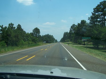
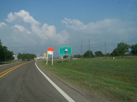
We went down to Port Arthur on US 175 and US 69. US 175 was surprisingly poorly built between Athens and Jacksonville. For most of that distance, US 175 was an old, narrow, hilly 2 lane road with no shoulders! I rarely see major US routes built so poorly in Texas.
The drive down US 69 brought back a few memories. In the late ‘80s, I lived in Groves, a suburb of Port Arthur. We would travel up US 69 almost to Tyler a few times a year to visit grandparents. I remembered things such as the mural painted on the side of a building (northeast corner of US 69 and TX 21) in Alto, the state hospital in Rusk, and the Pickett House Restaurant in Woodville.
In Lufkin, we stopped by the Texas Forestry Museum. Unless you live in the middle of southeast Texas, you don’t realize the enormity of the forestry industry. The museum clearly explains its scope and impact on the region. One interesting tidbit is that in foresting towns, you had your choice of religion as long as it was Baptist or Methodist. My favorite part was the fragrant pines that bordered a short walk around the back of the building.
Speaking of lumber, did you know that lumber trucks and pole trailers can be registered as farm truck and farm trailers?

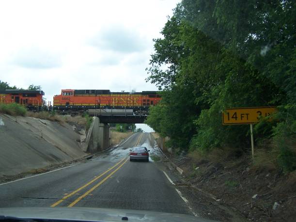
I never realized this until I snapped this photo on US 69 just north of Lufkin.
The major route around Lufkin is Loop 287. It multiplexes with US 69. I missed the photo op, but at one point North Loop 287 and South US 69 were going the same direction.
The Pickett House in Woodville was a big disappointment. Normally this is a great restaurant in an old school house building. They are currently renovating that building, so the restaurant moved to an adjacent property directly on US 190. This other building is decrepit and in poor repair. I experienced slow service, they didn’t have any sassafras tea (a staple at this place), and contrary to what was on the menu, the lemonade was just some mixed junk, not freshly squeezed goodness. The meal was not worth the $10.
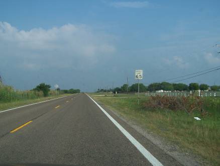
Heading further south, I noticed several miles of US 69 with double dashed stripes. How is this different than single dashed stripes?
Driving through Lumberton showed a surprising number of new developments. Lumberton is a northern suburb of Beaumont. This development is especially surprising considering that Beaumont was the worst metro area in the country for real estate values. Yes, Beaumont area property values recently declined!
Another goofy sign artifact I did not understand was how almost every 70 MPH speed limit sign on US 69 within 50 miles of Beaumont had a sticker for the 70 numerals. Here are some examples:
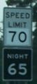
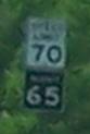
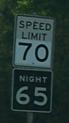
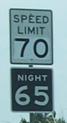

I don’t get it. Did the TxDOT Beaumont District reuse old 65/55 MPH signs back in December ’95 and ’96 when they posted these new signs? That doesn’t make sense because these signs would be 8-9 years old at this point. I don’t think the “pasted” parts would still look brighter. I also did not see evidence that the Beaumont area implemented any kind of environmental speed control scheme. (Technically a few counties on the west side of the Beaumont District are subject to environmental speed limits, but US 69 does not go through any of them.)
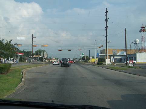
Speaking of speed limits, the Beaumont District has done the best job of any district I have been in on not posting arbitrarily low speed limits. While state law does not allow for arbitrary speed limits (unless the speed limit is posted at the statutory limit), the Dallas, Fort Worth, Austin, and Houston TxDOT districts use a rigid, formulaic approach for setting speed limits: 70 MPH outside the “outer” loop, 65 MPH between the “outer loop” and the “inner loop,” 60 MPH within the “inner loop,” and 55 MPH or less for all other non-interstate highways that are anywhere near anything that would hint of urbanization. (Note that due to environmental speed limits, all 70 and 65 MPH speed limits within about 50 miles of Houston or Dallas/Fort Worth are temporarily lowered an additional 5 MPH. Regardless, the “regulatory” limit, which will again apply once the environmental speed limits are lifted, still use this arbitrary formulaic approach.) Man, the Beaumont area was a breath of fresh air! I was astounded to see that US 69 was posted at 70 MPH all the way from Beaumont to TX 73 in Port Arthur. And TX 73 appears to be posted at 70 MPH through much of Port Arthur and Groves. FM 366 is posted at 65 MPH and 70 MPH for a good distance, something you would never see in other districts. Kudos for the Beaumont District for avoiding arbitrarily low speed limits!
Back to the trip.
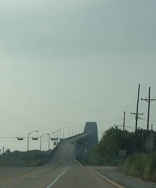
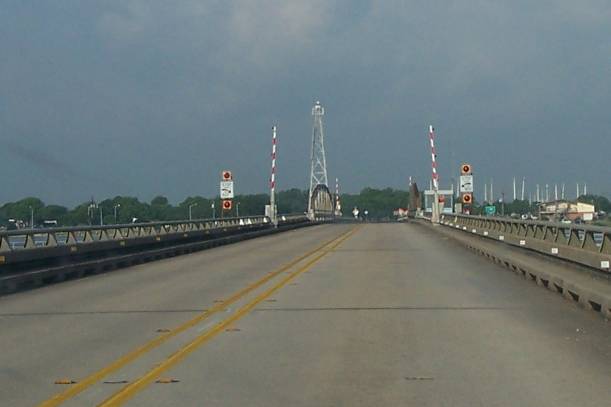
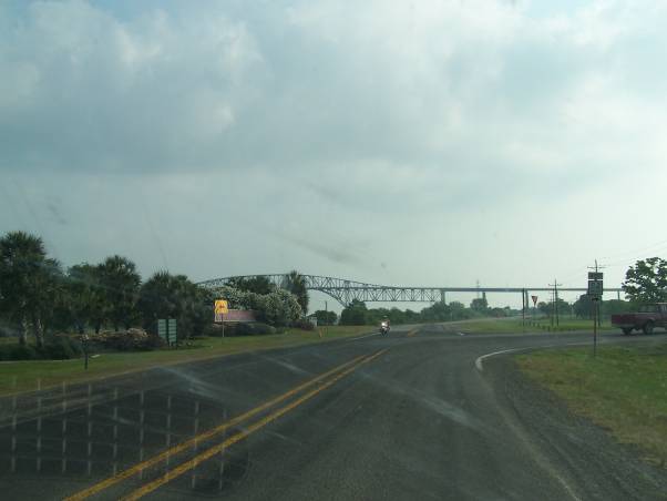
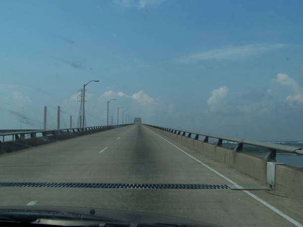
We continued south on US 69 directly to its terminus at TX 87. Then we took TX 87 through Port Arthur to Sea Rim. Here is TX 87’s bridge over the Intracoastal Waterway:
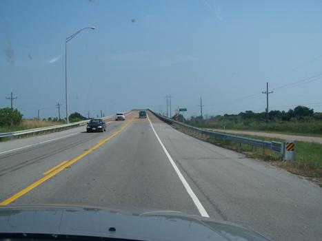
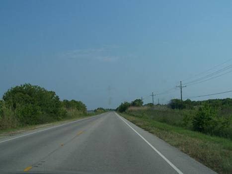
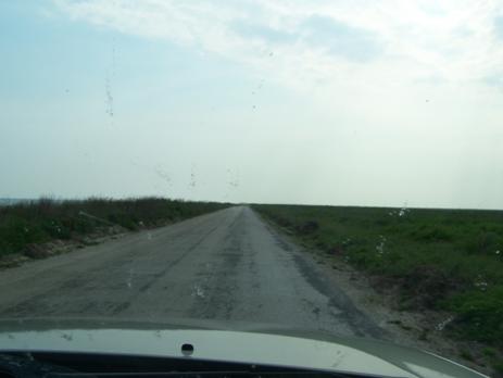
Despite the fact that TX 87 is washed out for about 25 miles between Sea Rim and High Island, it is still a well maintained road:
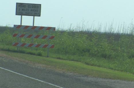
Here’s a sign warning of the road closure:
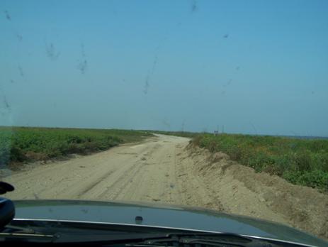
This is TX 87 past the road closure:
The striping has faded away, and the road is narrow. Pretty soon, the asphalt stops and a sand service road is all you have.
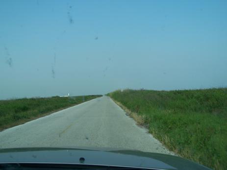
Coming back, here is where the sand road turns back into asphalt:
Another view of the closed part of TX 87:
When you depart Sea Rim State Park, you see this sign:
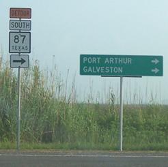
Even though Galveston is really about 45 miles to the west (left), you have to take a lengthy jog to the east and north avoid the washed out portions of TX 87.
I tried to take several good shots of the road, but my camera unfortunately did a better job of focusing on the windshield bugs. Case in point:
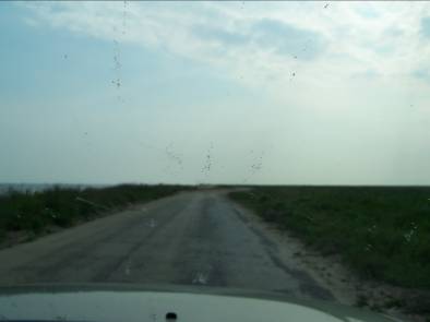
Oh, well.
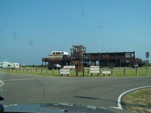
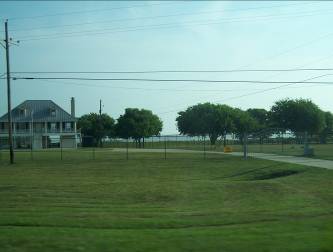
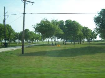
Here are the beach and main facility at Sea Rim:

I didn’t go into the water. I’ve never been much of a beach guy. The water is too nasty and salty, and you feel gross when you dry out.
That evening I tried my hand at long distance, long exposure night shots of offshore platforms. Here is one:
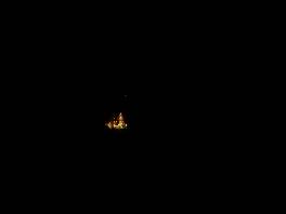
Same image, zoomed in and cropped:
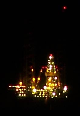
Same thing for another platform:
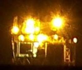
Both these pictures were taken on a tripod at my camera’s full 10X optical zoom, F/3.7, 100 ISO, and about 15 second exposure times. That’s about the best I can push my camera. I was amazed at the detail it was able to catch.
A few minutes later, I caught an image of some revelers who apparently thought this was a clothing optional beach. You can barely make out a human body on the left. It may have too many flesh tones to be clothed.

The only smart person in the group got a room at the Port Arthur Holiday Inn. The rest of us fought off horrible swarms of mosquitoes the whole night. I swear, I have never experienced such thick mosquitoes. When we retired to the tent for the night, we literally spent 15 minutes with a flashlight killing all the mosquitoes! None of us got great sleep, either.
But it wasn’t all bad. It was a great experience to hear the waves all night. At 3:30 AM, I awoke to see the full moon illuminating the whole area. And the stars were bright. You don’t get these experiences in north Texas.
One thing about camping is you can’t sleep in. There is too much light. We were up bright and early at 6:30 AM. Within an hour, we had packed up and showered and were off for our next adventure.
Here is a scene on the return trip into Port Arthur on Texas 87. You literally drive through a refinery right before you hit Texas 82:
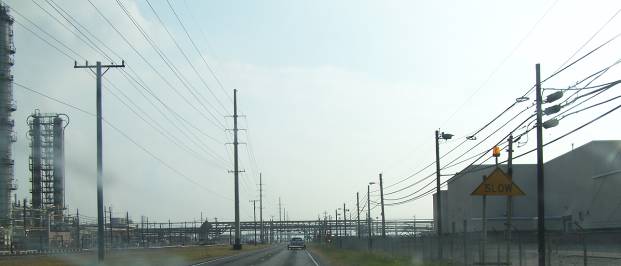
This experience has always fascinated me.
We then followed TX 82 across to Pleasure Island using the MLK Bridge:
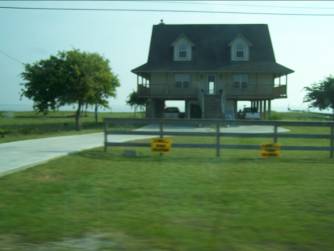
Before that drive, I never realized that anyone lives on Pleasure Island. Well, it’s true. Towards the southern end are a few really nice houses. Nearly all of them have signs opposing a proposed liquefied natural gas plant across the ship channel in Sabine Pass.
Here’s a detail of the signs:

It says LNG… TOO CLOSE. Tough luck, guys. Maybe you shouldn’t have built so close to an industrial area.
Since the mid-‘80s, I thought that the bridge connecting TX 82 to LA 82 at the end of Pleasure Island is a high causeway, similar to the TX 87 Intracoastal Waterway bridge. Boy, was I wrong. It is actually a draw bridge!
It isn’t wide, so I guess all the big ships headed to Beaumont have to pass through the channel separating Port Arthur from Pleasure Island.
Here are the views on the re-entry to Texas:
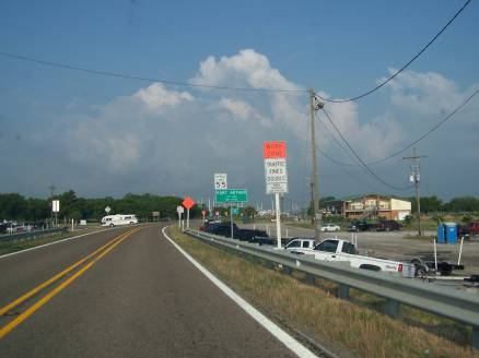
Fortunately, the speed limit goes up shortly after you enter the state:
Here’s another view of that MLK bridge:
On the way back to the hotel (where the smart guy stayed), we drove through downtown Port Arthur. Man, run down! It’s sad. Port Arthur could have been another fancy coastal city. I am not sure where it went wrong, except maybe not enough of the economy was diversified?

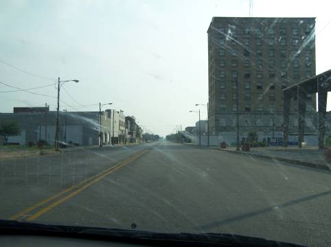

Yuck.
The next brief spot was Groves, where I snapped pictures of where I lived in the late ‘80s:
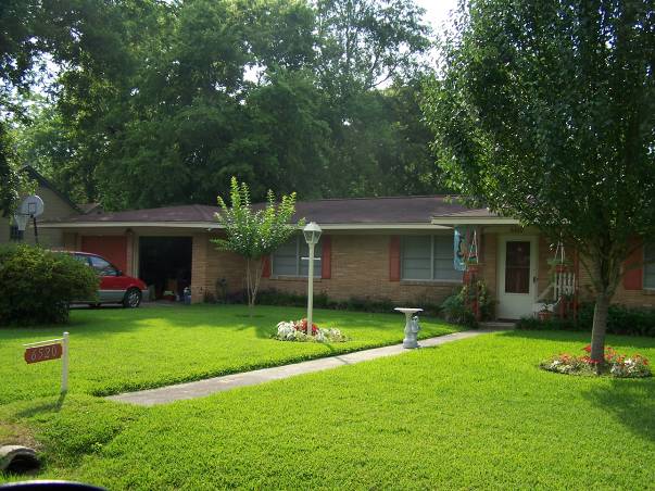
Sadly, the huge, decades old pecan trees that used to be in front of the house are gone. It almost looked like the current pastor was moving out.
Here’s the concrete area at the adjacent church where my brother wiped out on a bicycle with no brakes and gave himself a concussion:
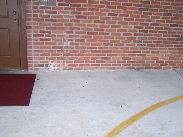
Any one of those spots could be his blood.
Here’s where I went for 4th and 5th grades.
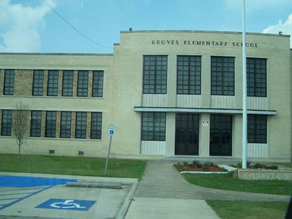
Mrs. Solberg’s room is just to the left of the front door.
Groves was a neat side trip. It had been around 15 years since I had last seen the city in daylight. The last time I was in Groves was January ’98. I took my wife (then my new girlfriend) in my “I just finished restoring it but still had a lot of work to do” ’74 Nova to Galveston and then to Groves. We arrived at around 7:00 PM, well after sunset. As soon as I exited off TX 73 to the main drag ( 39th St. ?), my alternator seized, eating up my water pump/alternator belt. I spent the next few minutes trying to find people I knew so that someone could take me to get a new belt. The job took two people: one to take me to K-Mart to get a new belt, and the other to tap out a bolt for the alternator I had in my trunk so that it would accept an SAE bolt and fit in my car. (Yes, I knew the alternator was going out. Don’t ask me why I didn’t replace it beforehand. Stupidity.)
Someday I want to go back to that town and spend a few hours revisiting old haunts.
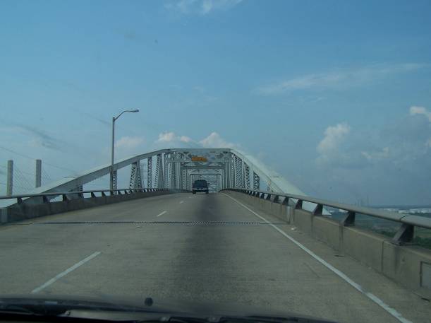
Next stop was the Rainbow Bridge and Veterans Bridge.
Here’s a view over the top of the Veterans Bridge:
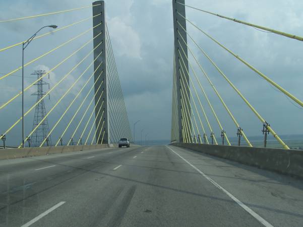
The Rainbow bridge is to the left:
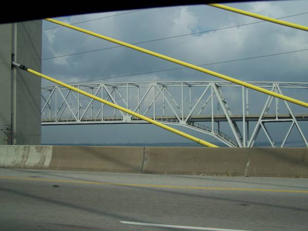
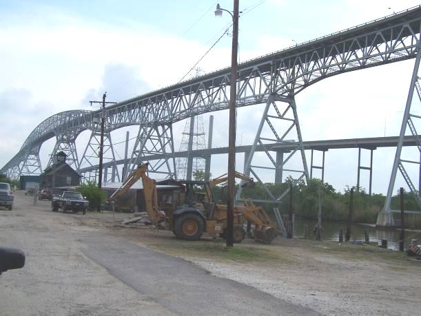
Just east of the bridges is a turnoff where you can get better pictures:

I REALLY like this picture:
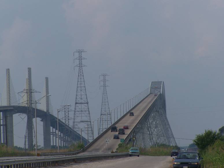
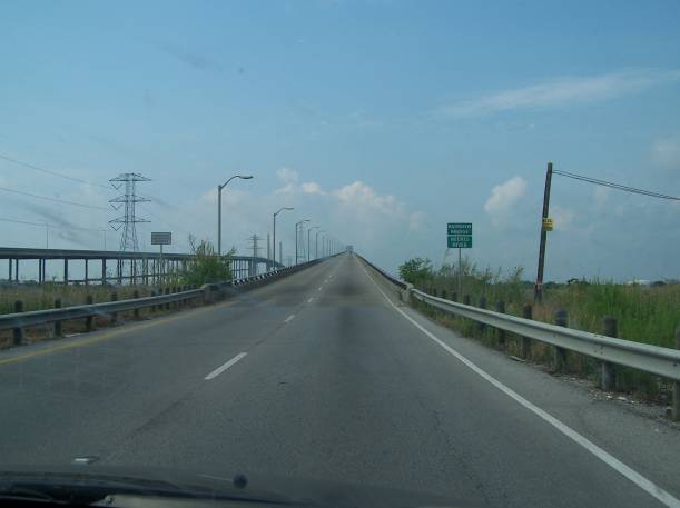
A drive up the Rainbow bridge:
When I lived in Groves, this bridge had narrower pavement, probably 9½’ or 10’ lane widths, and no shoulders. For comparison sake, 10’ lane widths are found on many Dallas roads. Imagine squeezing by an 18 wheeler at speed on this bridge! I also remember older style guardrails.
Just west of the bridge, we turned off into what may have been a private drive. We got great pictures of the bridge structure. A guy was watching us the whole time. It’s as if they get a lot of unwanted visitors.
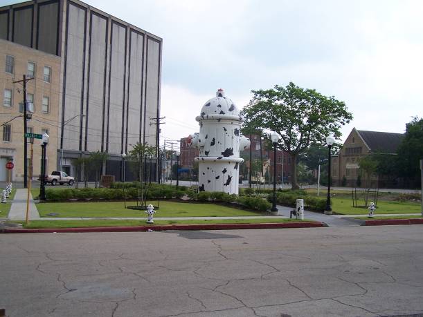
After that, we went to the Texas Energy Museum in Beaumont. We tried going to the Texas Fire Museum, but it was closed. We still got to see the “world’s largest fire hydrant”:
The drive to the lake house was uneventful.
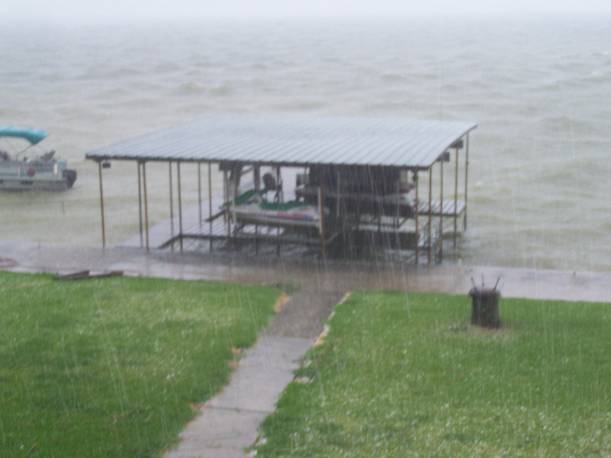
While at the lake house, we wore ourselves out on two jet skis. We also experienced a severe storm with hail and high winds. Here is where a rain gutter pushed out a bunch of hail:
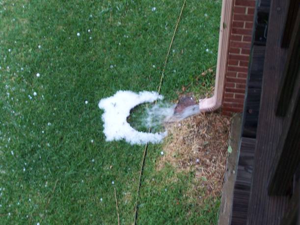
This is the hail pouring down:
After the lake house, we returned to Dallas via US 190 and I-45. In Huntsville, we stopped at The Junction Restaurant. It was great! For $6, I got a chicken fried steak, baked potato, salad, and rolls. What a deal!
We stopped by the Fairfield Dairy Queen. When you pull up, you see an innocuous Dairy Queen:
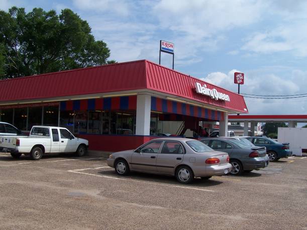
But turn to the left a bit, and you see a really weird house:
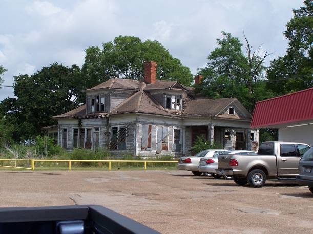
It’s a neat looking structure, but out of place. I wonder what stories that house has to tell? The Dairy Queen assistant manager said that the McDonald’s owner owns it. Checking the Freestone County Appraisal District records, that’s not true. The local McDonald’s is a corporate store. Even stranger, the Freestone County CAD site has no record for this DQ. It has the McDonald’s, the adjacent Texas Burger, the adjacent Exxon, and the Jack in the Box, but no Dairy Queen. I would like to know more about that house’s history.
Another guy took lots of shots of this house.
On our drive back, we detoured on to TX 75, the old US 75, to avoid a huge backup due to a wreck. On TX 75, we saw this railroad bridge near Streetman:
It was neat seeing this, knowing that everyone traveling between Dallas and Houston passed under this same bridge before I-45 was built.
The only other interesting note was Palmer’s cops were out running radar on I-45. Palmer is a speed trap south of Dallas that has no business running any traffic patrol operations on I-45; virtually nobody on I-45 is going to or coming from Palmer. Someday I want to inspect their records to see if they comply with the Texas anti-speed trap law that requires them to remit most ticket fines to state coffers.
That’s it for the trip. It was a fun and exhausting trip!
 The HOV system would have been a single, counterflow HOV lane. Now it’s going to be like the